Discovery of the Island
Heritage, Richness and Emotional Edge with Inspirations Voyage
Mauritius is located approximately 2000 km to the south eastern coast of Africa and lies east of Madagascar on 20°5, 57.5E. The country covers an area of 1865km_ with 330 km of coastline. Mauritius is 45km in width and 65km in length. Time zone; GMT +4.
Mauritius was first discovered by the Arabs. The first historical evidence of the existence of an island now known as Mauritius is on a map produced by the Italian cartographer Alberto Cantino in 1502. Cantino shows three islands which are thought to represent the Mascarenes (Réunion, Mauritius and Rodrigues) and calls them Dina Margabin, Dina Arobi. What is known is that the medieval Arab world called the south-western Indian Ocean island region Waqwaq.
Portuguese and Dutch Expedition
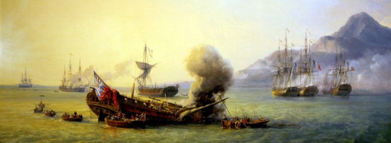
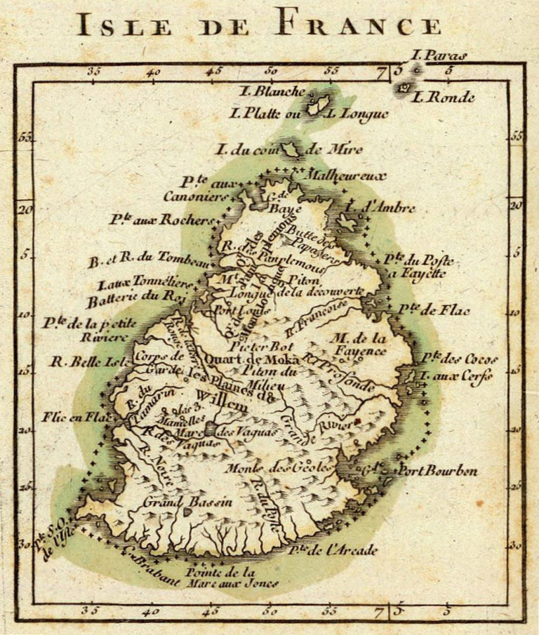
The first Europeans to have visited Mauritius were the Portuguese at the beginning of the sixteenth century (most probably in 1510). The Dutch who settled in the island in 1598 named it Mauritius after Prince Maurice of Nassau. Among other things, the Dutch introduced sugar cane and the Java deer before leaving in 1710 where they had found in the meantime a far better settling place: The Cape of Good Hope in South Africa. About five years later, in 1715, the French occupied the island, renaming it “Isle de France”.
French Settlement
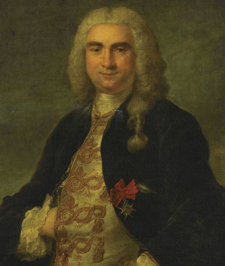
It was under the French Governor, Mahé de Labourdonnais, that Mauritius knew its first development: a harbor was built. Port Louis, named after the ruling king Louis XV, became the capital of Mauritius. Trade on the island thrived; Mauritius could supply enough sugar and rum to the surrounding islands and visiting vessels.
British Settlement
In 1810, the British conquered the island which they occupied, and Mauritius was formally ceded to them in the “Traité de Paris” of 1814. Most of the French settlers, remained on the island and were allowed to keep their customs, religion and laws.
A few years later, in 1835, the British abolished slavery – slaves at the time came from Madagascar, Senegal and Mozambique mainly – and this led to the importation of Indian indentured laborers to work in the sugar cane fields. They eventually settled in Mauritius and their descendants constitute nowadays the majority of the population.
Rapid development of the infrastructure continued. Free primary education was given to the population so that local civil servants could be trained to run the affairs of the country.
Independence
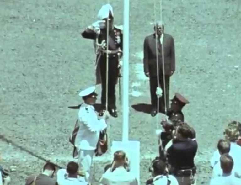
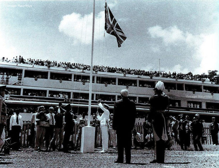
Mauritius achieved independence on 12 March 1968 and adopted a constitution based on the British parliamentary system.
The first post-independence years were difficult but after more than 15 years of planning and hard work, Mauritius achieved economic and political stability. Mauritius changed its status to that of a Republic on 12 March 1992. The Mauritian Constitution is based on the Westminster model. Political power is vested in the Prime Minister and the Cabinet. Elections are held every five years.
Republic
In December 1991, the Constitution was amended to make Mauritius a republic within the Commonwealth. Mauritius became a republic on 12 March 1992, with the last governor general, Sir Veerasamy Ringadoo, as interim president.